The Biblical Context: The Great Biological Reset
Before we look at the geology, we must understand the event described in Genesis 6. The ancient world was in a state of catastrophic decline. The text describes a corruption not just of morals, but of biology itself: “All flesh had corrupted his way upon the earth.” (Genesis 6:12).
To preserve the genetic purity of humanity and the animal kingdom, God initiated a global reset mechanism: The Great Flood. He commanded Noah to build a survival vessel—an Ark (Tevah in Hebrew, meaning “Box” or “Container”). The specific instructions were not for a sailing ship, but for a massive, rectangular barge designed for stability in extreme turbulence.
The Bible states that after 150 days of chaotic waters, “the ark rested… upon the mountains of Ararat.” (Genesis 8:4). Note the plural. It does not say the “peak” of Ararat, but the mountain range. For centuries, explorers climbed the frozen summit and found nothing. They were looking in the wrong place.
The Discovery: The Shape in the Mud
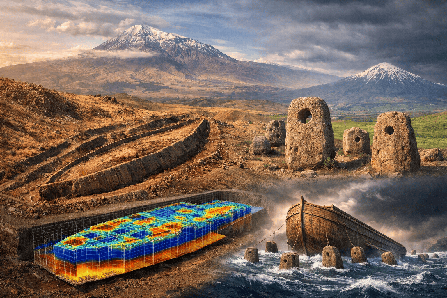
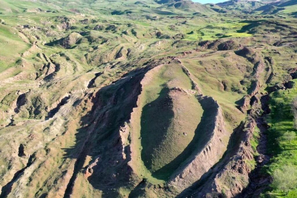
In 1948, a Turkish Army captain noticed a massive anomaly on a high-altitude aerial survey photo, located 29 kilometers south of the Great Ararat summit, at an elevation of 2,000 meters. It was a perfect, boat-shaped silhouette embedded in the flow of a mudslide.
This is the Durupinar Site. While mainstream geologists initially dismissed it as a “freak of nature” (a syncline fold), recent geophysical analysis suggests this is not a random rock formation. The dimensions, the sub-surface structure, and the surrounding artifacts align perfectly with the engineering specifications found in the Book of Genesis.
The Blueprint: Analyzing Genesis 6:15
The Bible gives precise engineering specifications for the vessel. “And this is the fashion which thou shalt make it of: The length of the ark shall be three hundred cubits, the breadth of it fifty cubits, and the height of it thirty cubits.” (Genesis 6:15)
The Engineering Challenge: A “cubit” is an ancient unit of measurement based on the forearm.
- The Common Cubit was approx. 18 inches (45.7 cm).
- The Royal Egyptian Cubit was approx. 20.6 inches (52.3 cm).
Since Moses was educated in the royal courts of Egypt (Acts 7:22), it is highly probable he used the Royal Cubit measurements. The Calculation: 300 Royal Cubits x 0.523 meters = 156.9 meters.
The Evidence: When researchers measured the length of the Durupinar formation, they found it to be exactly 157 meters (515 feet). The margin of error is less than the length of a human arm. In nature, erosion does not create geometric shapes that match specific ancient blueprints to the decimal point.
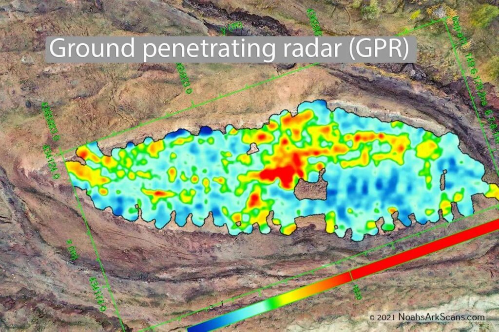
The Sub-Surface Grid (GPR Technology)
The most compelling evidence comes from Ground Penetrating Radar (GPR) and electrical resistivity scans. If this were a natural rock formation, the radar would show random, chaotic layers of stone. Instead, scans reveal a regular, orthogonal grid beneath the surface.
The data indicates:
- Parallel lines: Suggesting timber bulkheads.
- Right angles: Nature does not build in 90-degree angles; engineers do.
- Equidistant vertical structures: Suggesting the rib-timbers of a massive hull.
This implies that the object is not a solid rock, but a hollow structure that has collapsed and petrified over millennia.
The “Gopher Wood” Mystery: Advanced Composites?
Genesis 6:14 states: “Make thee an ark of gopher wood; rooms shalt thou make in the ark, and shalt pitch it within and without with pitch.”
No botanist has ever identified a “Gopher tree.” However, in Hebrew, Kofer also relates to “Pitch” or “Bitumen.” Critics argue that a wooden boat of that size would twist and break in the ocean. They are correct—if it were made of simple planks.
But the evidence at Ararat suggests Advanced Material Science. Chemical analysis of the soil within the formation shows abnormally high concentrations of aluminum and titanium—metals not found in the surrounding terrain. This suggests the “wood” was not just cut trees, but a Laminated Composite held together with synthetic resin (bitumen) and reinforced with metal fittings. It wasn’t a log cabin; it was a composite-hull vessel designed to withstand extreme hydrostatic pressure.
The Hydrodynamics: The Anchor Stones
Miles from the site, in the village of Kazan (formerly Arzap), archaeologists found massive stones standing upright. These stones weigh up to 10 tons each and have holes drilled through the top. Locals call them “Anchor Stones.” Marine engineers recognize them as Drogue Stones.
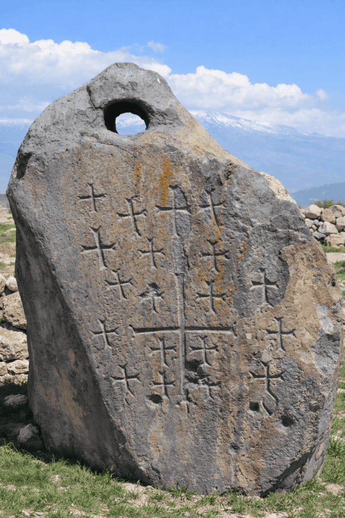
The Function: In ancient maritime engineering, you do not use a standard anchor in a deep flood. You use drogues—heavy weights dragged behind the ship.
- Stabilization: They keep the vessel perpendicular to the waves (facing the wind), preventing it from capsizing.
- Drag: They reduce speed and stabilize the ride in turbulent water.
Finding these specific maritime engineering tools 2,000 meters above sea level is the smoking gun. Ships do not just appear on mountains.
Conclusion
The Durupinar site presents a binary choice. Either it is a geological miracle—a rock that randomly formed into the exact dimensions of Genesis, containing metal alloys and organized grid patterns. Or, it is exactly what it looks like: the fossilized skeleton of the largest bio-engineering survival project in human history.